by Jack Taylor
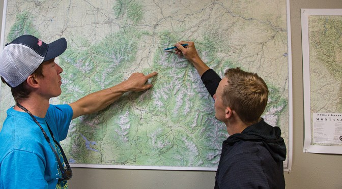
You’ve made it to Bozeman, and you’re ready to explore southwest Montana’s endless expanses. But where to go first? Start out by doing some research—it pays to have a plan for every excursion. Thankfully, you have a wealth of resources at your disposal to find the best trail, mountain, or stream for your next outing. Here are some of our top picks for getting the lay of the land.
Printed Guides
Nothing beats a quality, dedicated guidebook. Build a bookshelf collection for your favorite outdoor activities, and make sure these are included:
- Day Hikes around Bozeman (Day Hikes Books, $16)
- Southern Montana Singletrack (Beartooth Publishing, $30)
- Bozeman Rock Climbs (High Gravity Press, $25)
- Paddling Montana (Falcon Guides, $25)
- Cast: Fishing Southwest Montana (Outside Media Group, free)
- Stalk: Hunting Southwest Montana (Outside Media Group, free)
- The House of Hyalite (Joe Josephson, $36)
- Peaks and Couloirs of Southwest Montana (Chris Kussmaul, $45)
Printed Maps
Even in the age of digital everything, a good ol’ printed map is an invaluable resource. For close-to-home outings, start with the Gallatin Valley Land Trust’s map, which covers all the trails in and around Bozeman proper. It’s available from retailers around town for $3. (For a digital version, download one for free at gvlt.org/trails/trail-map.)
For Bozeman’s premier backyard playground, Hyalite Canyon, the nonprofit Friends of Hyalite makes a great fold-out recreation map in two versions: winter and summer. Pick one up around town for $5, or view it digitally at hyalite.org/recreation-maps.
Beartooth Publishing is our go-to for detailed topographic maps of southwest Montana, complete with roads, trails, and usage restrictions; order print copies from beartoothpublishing.com or find them in local stores. Our favorite all-around option is Bozeman Area Outdoor Recreation Map, which sells for $14.
For general trip planning throughout the state, pick up a copy of the DeLorme Atlas & Gazetteer (DeLorme, $25). For more detail, order zoomed-in, area-specific, waterproof maps from MyTopo (mytopo.com), a custom-mapping outfit in Billings. A large-format wall map of southwest Montana from Basin and Range Mapping (basinandrangemap.com) will help you see the big picture and make planning that much easier.
Apps
For hunters and anglers, there are only three apps you need on your smartphone or GPS: Montana Fishing Access, Montana Hunting Access, and OnX Hunt. The first two are activity-specific and produced right here in Bozeman by Mountainworks Software (emountainworks.com); the latter is the leading map for property-ownership boundaries and is based in Missoula (onxmaps.com).
Websites
You’ll find plenty of information online to learn about local outdoor opportunities. For a collection of general resources, head to outsidebozeman.com and poke around—all day, if you’re not careful. Looking for specific trail descriptions? Check out outsidebozeman.com/trails, hike.wildmontana.org, gvlt.org/trails/featured-trails, or trailforks.com. For updates and news in the world of mountain biking, including suggested rides, take a look at southwestmontanamba.org. Climbers, head to swmontanaclimbers.org for access information and stewardship projects. If you’re heading for the rivers, check out waterdata.usgs.gov for water levels, bigskyfishing.com for angling info, and fwp.mt.gov for fishing regulations. In the winter, if you plan on heading into the backcountry, stay updated with avalanche forecasts from mtavalanche.com. For general tips & tricks regarding outdoor safety and skills, check out outsidebozeman.com/skills.
Stores
Nothing beats a well-stocked retailer for hands-on gear comparisons, along with free advice from local professionals. Southwest Montana teems with outdoor shops; stop in and hit ‘em up for tips and guidance. Just be sure to buy something while you’re there; Montanans are a friendly, helpful lot, but nobody likes a freeloader.